
Project BG161PO004-5.0.01-0059
Design and Implementation of Geographic Information System (GIS) for Port Infrastructure Management
The project is financed by European Regional Development Fund and the national budget through the Operational Programme on Transport 2007–2013 under Priority Axis „Technical Assistance”
On 19.04.2011 Bulgarian Ports Infrastructure Company concluded Contract for grant provision with the Ministry of Transport, Information Technologies and Communications – Contracting Authority of Operational Programme on Transport 2007 -2013: COPT-5/19.04.2011 for the implementation of the project Design and Implementation of Geographic Information System (GIS) for Port Infrastructure Management. Total project amount 4 923 000, 00 BGN. Funds are provided by the European Regional Development Fund under Priority Axis V „Technical Assistance” of OPT. In Annex № 3, ref. No: COPT – 39/05.12.2013 changes in the budget are made and the total amount is reduced.
Total project cost: 4 703 728, 60 BGN.
Funded by the European Regional Development Fund: 3 352 207, 76 BGN.
National co-financing: 591 566, 07 BGN.
Beneficiary: Bulgarian Ports Infrastructure Company
The territorial scope of the project includes the Bulgarian public transport ports of national importance.
Legal framework:
The project is consistent with the Law on Maritime Spaces, Inland Waterways and Ports of the Republic of Bulgaria and adopted National Program for the ports development, according to which the main trend for future development is modernization and reconstruction of port infrastructure and the introduction of modern telecommunications and information technologies. Modernization of port infrastructure and services is in compliance with the principles of the market economy of the European Union.
Objectives:
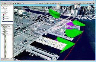
The project aims to build a geo-information system in which to maintain current data on the state of port infrastructure, land, buildings, facilities, and road and railway terminals, warehouses, adjacent water areas and etc. GIS technology allows the accumulated data and information to be used for specific investigations, resource management, regional and country planning and economic modelling processes. The system allows creating and maintaining databases and analysis of information about the ports of national importance. It is envisaged port infrastructure GIS to support data exchange with other information systems.
Project implementation created conditions for optimization the management of the state assets in port infrastructure, and also more efficient spending of funds for maintenance and modernization of the Bulgarian ports as part of the transport network of the European Union.
Users of GIS:
- Employees of Bulgarian Ports Infrastructure Company;
- State administration and public institutions;
- Specialized institutions, using this kind of information;
End beneficiaries:
- Participants in passenger and freight traffic in the sea and river ports and inland water transport;
- Cargo carriers in sea and river ports;
- Transit passengers and vehicles in the Bulgarian territorial waters of the Black sea and in the Bulgarian part of the Danube River;
- Insurance services for passengers on inland waterways to and from European union countries;
- Economically active persons in the region;
- Investors and concessionaires.
GIS functionality for port infrastructure management:
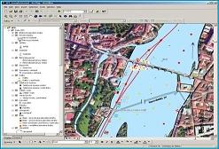
- Input and editing of spatial information – for each site can be created electronic dossier with the necessary information, a site map, specific parameters and characteristics;
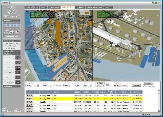
- Automatic generation of references and analysis required for the daily work of BPI Co. employees;
- Option for simultaneous access to the system for employees in the Head Office, and the Territorial Divisions – branches in Varna, Burgas, Ruse and Lom;
- Creation and maintenance of digital drawing archive;
- Management of long term assets;
- Maintenance of data for the chronology of inspections in facilities of port infrastructure and for the experts’ findings about their condition ;
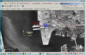
- Option for visualization of the condition of the facilities (monitoring from a distance).
The implementation of the Geographic Information System of BPI Co. contributes to:
- Development of the information systems in the company and reach to standards of maritime and inland waterway transport in the European Union;
- Revitalize the planning and development of investment projects, including those financed with EU funds and accelerate the process of their implementation in the current and next programming period;
- Development and validation of intelligent transport systems;
- Developing specialized systems for asset management of port infrastructures;
- Keeping an update register of assets of the port infrastructure
- Improving effectiveness and efficiency in the management of port infrastructure;
- Optimize the collaboration of different units in the structure of Bulgarian Ports Infrastructure Company.
Project Contractors:
- Contract № CEP-1/04.02.2014 with consortium „GeoPort” with subject: Design and Implementation of GIS for the needs of Bulgarian Ports Infrastructure Company;
- Contract № CEP-2/04.02.2014 with “BITMAP” EOOD with subject: Monitoring and supervising the implementation of the contract: “Design and Implementation of GIS for the needs of Bulgarian Ports Infrastructure Company”.
Contracts are executed successfully. From 22.08.2014 the Geographic Information System for management of the port infrastructure is operational.
GIS data will be accessible to external users through the National Spatial Data Portal, which is under construction and maintenance by Executive Agency "Electronic communications networks and information systems” to the Minster of Transport, Information Technologies and Communications”. Through the portal will liaises with geo infrastructure for spatial information in the European Community (INSPIRE).
Services are public, free and available while ensuring interoperability in accordance with the Law on access to spatial data.
Until organization of a National Spatial Data Portal from October 23, 2014 Bulgarian Ports Infrastructure Company introduced a new service „WEB-GIS system of BPI Co. The electronic service can be registered free of charge by filling Application – declaration here
WEB-GIS system of BPI Co. offer electronic access to information to the available information in the geographic information system of the port infrastructure.

Project Manager:
Natasha Ceneva – Director Infrastructure, Port Water Area and Property, Tel. 02 807 99 37, n.ceneva@bgports.bg